
Cham, Yazd
Cham
چم | |
|---|---|
village | |
 Village of Cham | |
 Cham | |
| Coordinates: 31°47′20″N 54°15′23″E / 31.78889°N 54.25639°E | |
| Country | |
| Province | Yazd |
| County | Taft |
| Bakhsh | Central |
| Rural District | Pishkuh |
| Population (2006) | |
| • Total | 11 |
| Time zone | UTC+3:30 (IRST) |
| • Summer (DST) | UTC+4:30 (IRDT) |
Cham (Persian: چم)[1] is a village in Pishkuh Rural District, in the Central District of Taft County, Yazd Province, Iran. At the 2006 census, its population was 11, in 5 families.[2]
References[edit]
- ^ Cham can be found at GEOnet Names Server, at this link, by opening the Advanced Search box, entering "222007" in the "Unique Feature Id" form, and clicking on "Search Database".
- ^ "Census of the Islamic Republic of Iran, 1385 (2006)" (Excel). Statistical Center of Iran. Archived from the original on 2011-09-20.
-
 Windtowers in Cham
 -
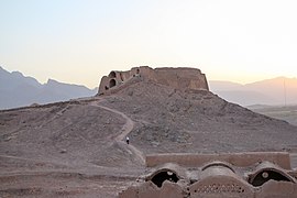 Tower of Silence in Cham
 -
 Ritual buildings under the Tower of Silence in Cham


This Taft County location article is a stub. You can help Wikipedia by expanding it. |