
File:Europoort osm.png

Size of this preview: 800 × 403 pixels. Other resolutions: 320 × 161 pixels | 640 × 323 pixels | 1,345 × 678 pixels.
Original file (1,345 × 678 pixels, file size: 741 KB, MIME type: image/png)
| This is a file from the Wikimedia Commons. Information from its description page there is shown below. Commons is a freely licensed media file repository. You can help. |
Summary
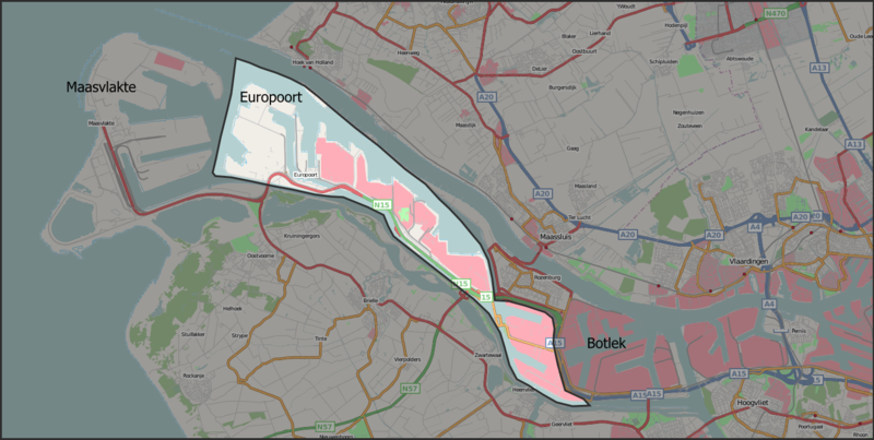
| Description | Map of the Europoort harbour area in Dutch municipality of Rotterdam. The background map is taken from Openstreetmap.org. The boundary was drawn by me using the description in the Dutch Europoort article. |
| Date | |
| Source | Openstreetmap.org ([1]) + own work |
| Author | Contributors of the relevant openstreetmap.org data + Mtcv |
| Permission (Reusing this file) |
CC-BY-SA-2.0 |
Licensing
This file is licensed under the Creative Commons Attribution-Share Alike 2.0 Generic license.
- You are free:
- to share – to copy, distribute and transmit the work
- to remix – to adapt the work
- Under the following conditions:
- attribution – You must give appropriate credit, provide a link to the license, and indicate if changes were made. You may do so in any reasonable manner, but not in any way that suggests the licensor endorses you or your use.
- share alike – If you remix, transform, or build upon the material, you must distribute your contributions under the same or compatible license as the original.
File history
Click on a date/time to view the file as it appeared at that time.
| Date/Time | Thumbnail | Dimensions | User | Comment | |
|---|---|---|---|---|---|
| current | 14:42, 9 November 2007 | | 1,345 × 678 (741 KB) | Mtcv | {{Information |Description=Map of the Europoort harbour area in Dutch municipality of Rotterdam. The background map is taken from Openstreetmap.org. The boundary was drawn by me using the description in the Dutch Europoort article. |Source=Openstreetmap.o |
File usage
The following pages on the English Wikipedia use this file (pages on other projects are not listed):
Global file usage
The following other wikis use this file:
- Usage on ca.wikipedia.org
- Usage on el.wikipedia.org
- Usage on en.wiktionary.org
- Usage on fi.wikipedia.org
- Usage on fr.wikipedia.org
- Usage on is.wikipedia.org
- Usage on ka.wikipedia.org
- Usage on nl.wikipedia.org
- Usage on ru.wikipedia.org
- Usage on tr.wikipedia.org
- Usage on uk.wikipedia.org
- Usage on www.wikidata.org