
File:Diplomatic missions in Israel.png

Size of this preview: 800 × 338 pixels. Other resolutions: 320 × 135 pixels | 640 × 270 pixels | 1,480 × 625 pixels.
Original file (1,480 × 625 pixels, file size: 69 KB, MIME type: image/png)
| This is a file from the Wikimedia Commons. Information from its description page there is shown below. Commons is a freely licensed media file repository. You can help. |
Summary
| Description |
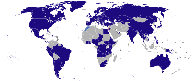
English: Map of diplomatic missions in Israel
Español: Mapa de misiones diplomáticas en Israel
עברית: מפת המדינות שיש להן משלחות דיפלומטיות בישראל العربية: خريطة الدول التي أقامت بعثات دبلوماسية في إسرائيل |
| Date | |
| Source | Own work |
| Author | Aquintero82 |
| Permission (Reusing this file) |
I, the copyright holder of this work, hereby release it into the public domain. This applies worldwide. |
Licensing
| I, the copyright holder of this work, release this work into the public domain. This applies worldwide. In some countries this may not be legally possible; if so: I grant anyone the right to use this work for any purpose, without any conditions, unless such conditions are required by law. |
File history
Click on a date/time to view the file as it appeared at that time.
| Date/Time | Thumbnail | Dimensions | User | Comment | |
|---|---|---|---|---|---|
| current | 04:10, 2 May 2024 | | 1,480 × 625 (69 KB) | Aquintero82 | Removed Colombia |
| 06:02, 16 January 2024 |  | 1,480 × 625 (69 KB) | Aquintero82 | Added Malawi | |
| 03:34, 5 September 2023 |  | 1,480 × 625 (69 KB) | Aquintero82 | Added Papua New Guinea | |
| 02:03, 6 July 2023 |  | 1,480 × 625 (69 KB) | Aquintero82 | Removed Venezuela | |
| 21:50, 17 February 2023 |  | 1,480 × 625 (69 KB) | Aquintero82 | Updated color for South Africa | |
| 16:55, 2 February 2023 |  | 1,480 × 625 (69 KB) | Aquintero82 | Added Chad | |
| 06:08, 20 November 2022 |  | 1,480 × 625 (69 KB) | Aquintero82 | Added Azerbaijan | |
| 16:20, 15 October 2022 |  | 1,480 × 625 (69 KB) | Aquintero82 | updated map | |
| 02:33, 6 October 2022 |  | 1,480 × 625 (69 KB) | Aquintero82 | Added Venezuela | |
| 18:54, 21 February 2022 |  | 1,480 × 625 (45 KB) | Heitordp | Added Kosovo and circles for small countries, improved shapes |
File usage
The following pages on the English Wikipedia use this file (pages on other projects are not listed):
Global file usage
The following other wikis use this file:
- Usage on ar.wikipedia.org
- Usage on bn.wikipedia.org
- Usage on de.wikipedia.org
- Usage on fa.wikipedia.org
- Usage on he.wikipedia.org
- Usage on hy.wikipedia.org
- Usage on ja.wikipedia.org
- Usage on ru.wikipedia.org
- Usage on tr.wikipedia.org
- Usage on uk.wikipedia.org
- Usage on zh.wikipedia.org